Create Your First Project
Start adding your projects to your portfolio. Click on "Manage Projects" to get started
Hurricane Sandy Impacts on Two Bridges Neighborhood
Location
Two Bridges, New York, NY
Date
Fall 2024
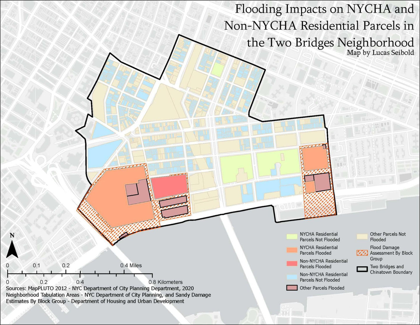
The project Hurricane Sandy in Two Bridges examined the disproportionate impacts of flooding on public versus private housing in Manhattan’s Two Bridges neighborhood, an area situated between the Brooklyn and Manhattan Bridges. The research highlighted how low elevation, aging infrastructure, and socioeconomic vulnerability compounded the effects of Hurricane Sandy on residents, especially those living in NYCHA developments. Using data from NYC Open Data, HUD, and community interviews, the study found that NYCHA buildings reported significantly more damage than private housing. Interviews with residents, shop owners, and community leaders revealed ongoing concerns about inadequate flood protections, delayed recovery, and inequitable planning processes. The project concluded by recommending improved evacuation planning, more equitable resource distribution, and greater resident participation in resilience planning.
You were responsible for the project’s GIS and data analysis components. This included collecting and processing spatial datasets such as MapPLUTO, Sandy Inundation Zones, and HUD’s damage estimates, as well as conducting statistical analyses to compare the extent of storm impacts between NYCHA and non-NYCHA properties. You created maps visualizing flood exposure and damage patterns across Two Bridges, and you performed a two-sample proportion test to assess differences in the effects. Your GIS work provided the quantitative foundation for the team’s findings, connecting physical vulnerabilities to broader issues of housing equity and climate resilience.


